


Britain could be just a fortnight from the first ‘significant’ snow dump of the season as violent storms unleash the fury of the Arctic.
Vicious cyclones stirring up gale-force winds and torrential downpours threaten to hasten the arrival of winter’s first early assault.
Low-pressure systems will plough in from the north after the weekend bringing the first flurries to the Highlands, experts say.
Snow will fall to lower levels by mid-month, with much of the country on alert through the end of the year.
James Madden, forecaster for Exacta Weather, said: “Low pressure from the north next week is likely to bring some snow over high ground, and from around mid-month, there will be a greater risk of more significant dumps of snow, again across high ground, but later to lower levels.
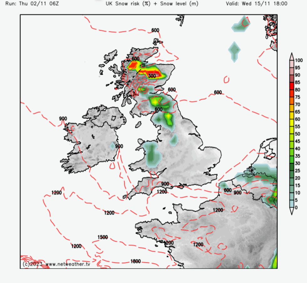
Snow risk widens from mid-month
|Netweather.tv
“In addition, as temperatures drop through this month, we are expecting the risk of widespread frosts becoming commonplace.
“This will become more likely from around mid-month, or possibly a little earlier.”
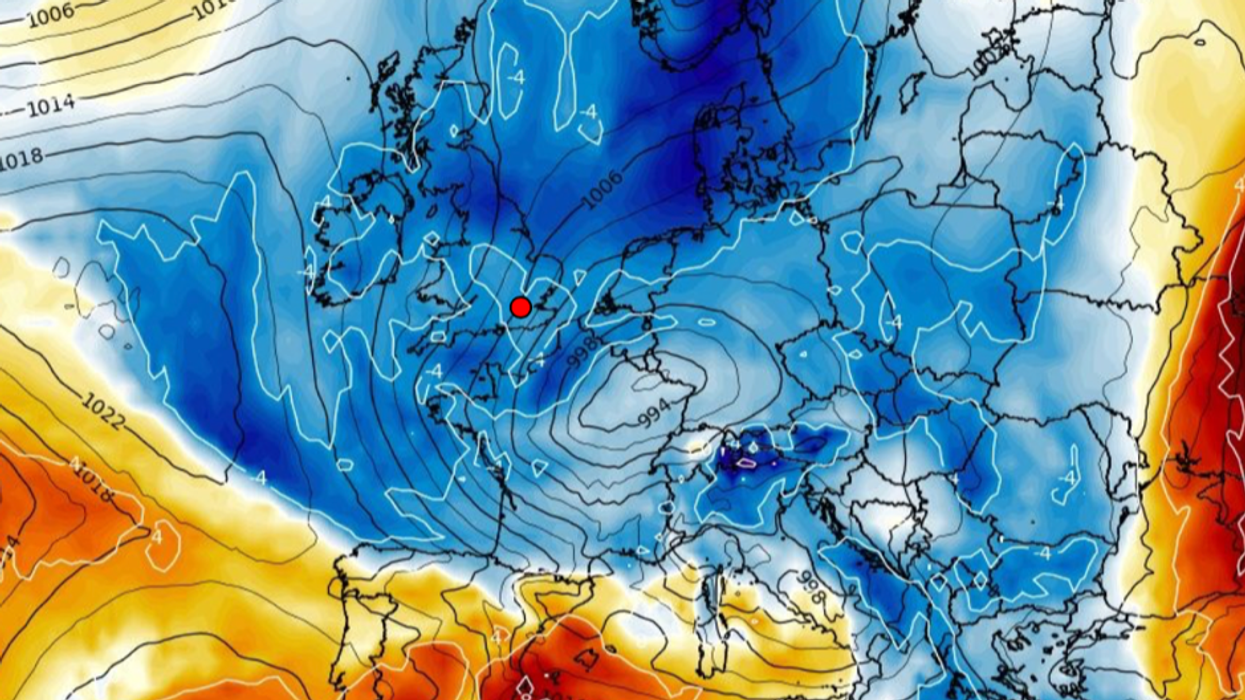
The warning comes as Britain reels from a 100mph blitz from Storm Ciaran which tore in on Wednesday smashing buildings and tearing down trees.
The vicious ‘bomb cyclone’ unleashed the most savage assault since last year when the nation was mauled by Storm Eunice.
The storm deepened explosively as its central pressure plummeted 24millibars in 24 hours–earning the title ‘weather bomb’ or ‘bomb cyclone’.
Further storm systems are lined up to hit the UK this month, although the origin of their journey is likely to turn northerly.
Mr Madden said: “This could bring a more wintry theme across much of the country by December.”
However, the jury is still out on the overall winter picture with some meteorologists predicting milder conditions through the rest of the year.
Global climatic drivers, including a strong El Nino ocean warming in the eastern Pacific, could delay the arrival of heavy snow until the start of 2024.
Meteorologists are also watching the Indian Ocean Dipole (IOD), a delicate interaction between the Indian ocean and the atmosphere which could affect the UK winter.
The IOD is currently in a strengthening positive phase which, with El Nino, could drive a milder December with the risk of colder weather delayed to January.
Netweather meteorologist Nick Finnis said: “I’m strongly swayed to thinking that December and perhaps a good chunk, if not all of January, will be mild and sometimes, if not much of the time, unsettled.
WATCH: 3rd November weather forecast
“The second half of January or early February onwards may see greater potential for northern blocking episodes … with the potential for cold northerly winds occasionally but also Atlantic systems crossing the UK on a more southerly track.”
Easterly winds eyeing up the UK could plumet temperatures by the end of the month bringing snow to parts.
The Met Office said that while temperatures are expected to stay close to normal next week, the mercury could drop towards the end of the month.
A spokesperson said: “Temperatures will be around normal for the time of year, but in any drier interludes, particularly if the wind comes from a more easterly direction, temperatures could take a dip with some frost by night.
“As would often be expected in late November, some of the precipitation is likely to turn increasingly wintry, mainly on high ground in the north.”