
UK COLD weather forecast: Britain set for 'TOPPLER' deep freeze
Temperatures are set to plunge as Britain faces a northerly 'toppler' cold snap next week, according to the latest weather maps
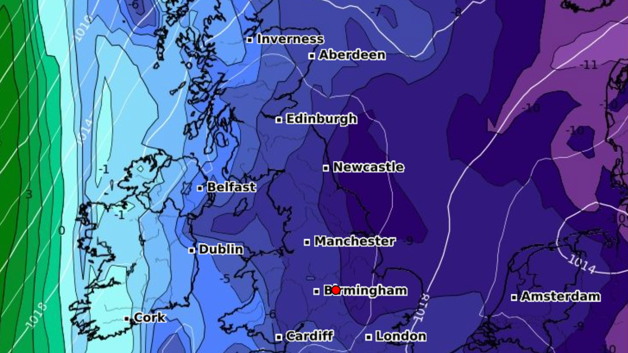
|WXCHARTS


Conditions are set to turn cold with sub-zero temperatures
Don't Miss


Most Read


Latest
Temperatures are set to plunge as Britain faces a northerly "toppler" cold snap next week, according to the latest weather maps.
Experts suggest the next area of low pressure will bring more wet and windy weather this weekend.
Next week looks set to see drier weather, particularly in southern and western regions with some fluctuations in temperatures day to day.
WX Maps shows conditions turning colder later next week with sub-zero temperatures.
Weather expert Gavin Partridge said: "After an unsettled start we see high pressure taking over next week.
"This will bring drier weather especially to more southern and western regions but with the position of the anticyclone changing day by day we will also experience temperatures fluctuations.
"So some days it will be relatively mild with southwesterly winds but other days could be cold.
"There's a chance we might get a brief northerly 'toppler' cold snap from the north although there's a lot of uncertainty."
Over the weekend, temperatures are expected to hit maximums of 11C and lows of 4C or 5C.
Temperatures could drop below 0C for the first time, with some areas to see lows of -7C next week.
On Wednesday, November 22, maps show a cold spell moving in from France and the Netherlands.
The Met Office predicts "fairly changeable" weather conditions.
Partridge said: "Sunday will bring further heavy shower and longer spells of rain to much of the country.
"Through the morning all places will be at risk of wet weather but the afternoon should see the weather starting to turn drier across Scotland and Northern Ireland while England and Wales continue to have further showers and spells of rain.
"Winds remain strong and gusty with gale force gusts reaching 60MPH across south Wales and south west England. Temperatures will still be mild but slight cooler than today at 7C to 13C.
"Friday and next weekend have a lot of uncertainty but we might see high pressure pulling further west allowing colder northerly winds to push southwards (temporarily) perhaps bringing a risk of wintry showers (snow showers for Scotland) and night frost.
"Any cold snap will probably be short-lived with milder westerly winds returning by the end of next weekend."