
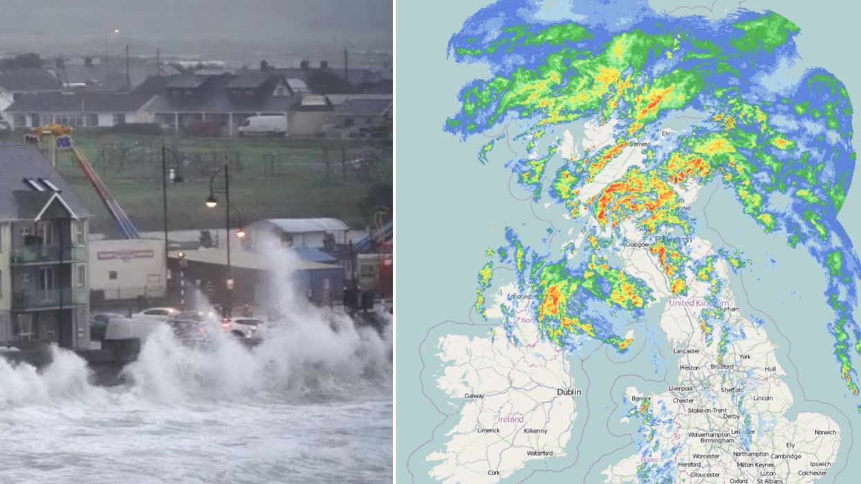


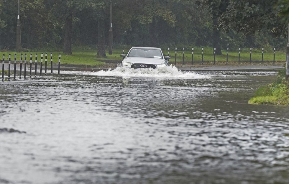
Storm Agnes - the first named storm of the meteorological year - has hit the UK.
It is expected to bring strong winds and heavy rain which could result in widespread disruption.
The Met Office and Met Éireann have warned of potential travel chaos as the storm hits.
The storm could also see an increased risk of flooding in certain areas.
WATCH NOW: Storm Agnes forecast
The seasonal storm is also set to bring with it roughly 2.4 inches of rain in parts of the country.
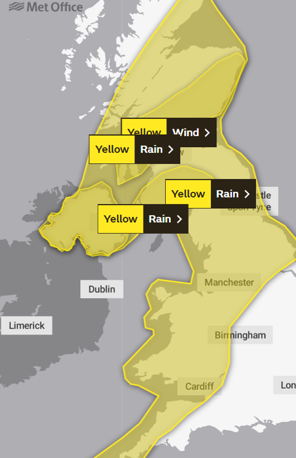
Meanwhile, a yellow weather warning for wind has been issued by the Met Office, covering large parts of the UK, including Manchester, Cardiff, and Belfast.
THIS BLOG IS NOW CLOSED.
FINAL UPDATE TONIGHT
Wet and windy weather has already spread across Ireland and Northern Ireland into western parts of Britain.
The rain will be heaviest and most persistent over parts of Scotland, Ireland and Northern Ireland.
Weather warnings remain in place until 7am on Thursday, September 28.
20:30pm UPDATE: More than 500 properties in north Cornwall lose power
National Grid say 530 properties have been affected in the Jacobstow area along with 50 around Westward Ho! in north Devon.
The strongest gusts have been 63mph (101km/h) on the Isles of Scilly and 49mph (79km/h) in Newquay.
Coastguards are warning people to "take weather warnings seriously and stay safe".
19.10pm UPDATE: 'Dangerous building incidents' and flooding in Cork
 |
| Cork City Council/ Twitter
Cork City Fire Brigade say they have been called to "dangerous building incidents" across the area.
A statement said flooding and several downed trees have also been dealt with this afternoon during a "busy shift".
Orange wind warnings have been extended for another two hours until 7pm in the country.
18:00pm UPDATE: 1,500 homes without power
NI Electricity has warned that power cuts are possible, and ESB networks are showing power faults in a number of counties including Cork, Wexford and Tipperary.
A total of 1,500 homes are currently without power in Co Armagh.
Winds of up to 80mph are expected to hit parts of Ireland later today as weather warnings remain in place.
17:30pm UPDATE: Roof blown off building
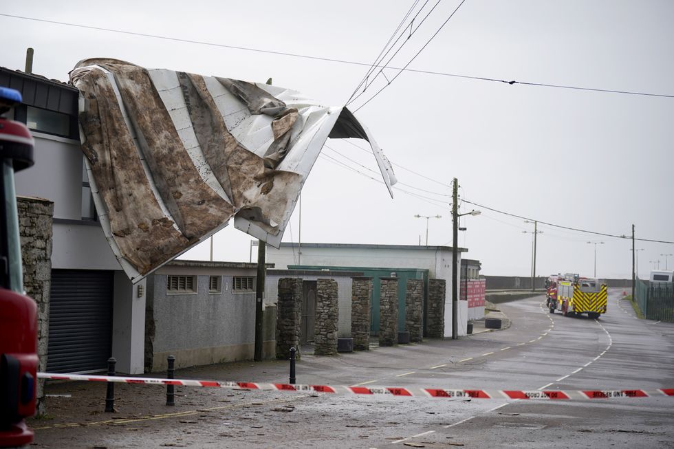
The scene in Youghal, Co Cork, where a roof has been blown from a building
|PA
Damaging winds and big stormy seas have caused disruption in Youghal, Co Cork with one roof being ripped off a building.
Agnes, the first named storm of the season, will affect western regions of the UK and Ireland, with the most powerful winds expected on the Irish Sea coasts.
A yellow alert for rain is in force until 8pm, while a wind alert will remain in place until 7am on Thursday.
17:00pm UPDATE: Flight and ferry travel disruption
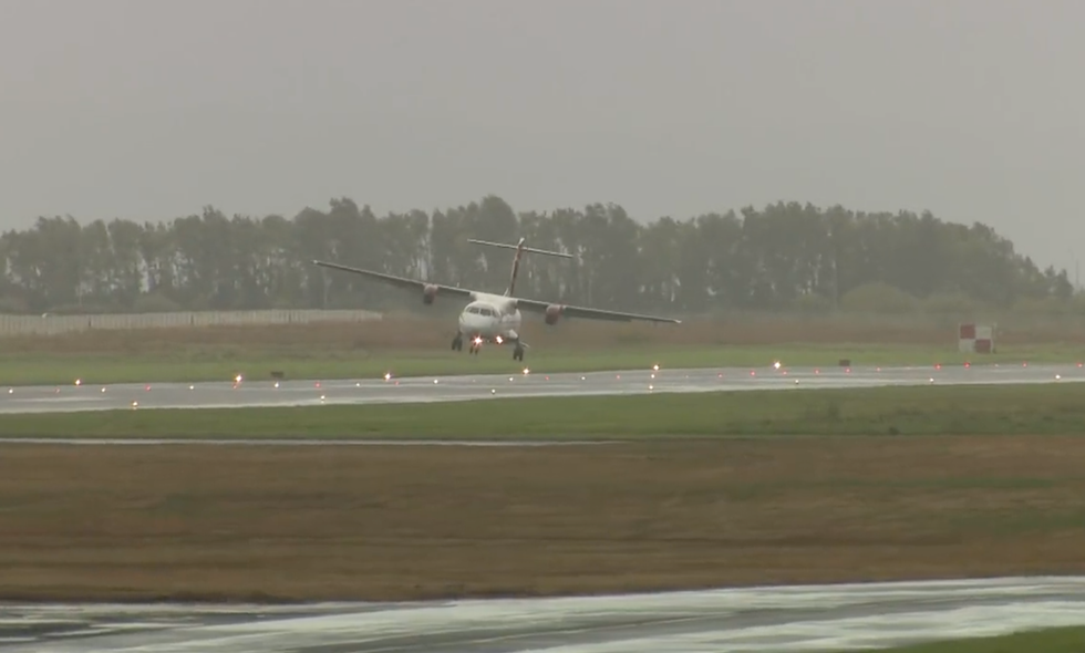
Flights have struggled to land at Belfast airport due to Storm Agnes
|Flights to and from Belfast airport have been cancelled as Storm Agnes rages on.
A spokesperson for Belfast City Airport has said: "Disruption to schedules across the UK due to the weather is likely.
"Passengers are advised to check the status of their flights with their airline before travelling to the airport. Flight information can also be viewed at belfastcityairport.com"
All of Wednesday's daytime passenger ferry sailings to and from the Isle of Man have been cancelled due to expected gales across the Irish Sea.
15:50pm UPDATE: Storm Agnes is set to cause chaos until 7am on Thursday
Storm Agnes will batter parts of the UK until 7am on Thursday morning.
The warning area has been extended further east and north, now covering Perth, Dundee and Aberdeen.
Strong winds and heavy rainfall has arrived from the south this afternoon bringing 30-50 mm of rain, perhaps 60 mm in a few spots across higher ground.
14:50pm UPDATE: Electricity supplies could be impacted
Our engineers are busy preparing for #StormAgnes.
— ElectricityNorthWest (@ElectricityNW) September 27, 2023
Strong winds can make it difficult and unsafe for our engineers to work in. If you experience a power cut, we will try our best to get your power back on as soon as it is safe for our engineers to carry out repairs.
Electricity North West said that their engineers are busy preparing ahead of the upcoming storm.
They said: "Strong winds can make it difficult and unsafe for our engineers to work in. If you experience a power cut, we will try our best to get your power back on as soon as it is safe for our engineers to carry out repairs."
Blackburn with Darwen Council has shared advice on how to prepare for an outage.
The council said there was "no need to panic" but said it was a "good idea" to be prepared.
13:52pm UPDATE: Rail services in England issue warnings of disruption
🍃 Due to forecasted strong winds this afternoon, our services between the North West of England and Scotland may be affected.
— TPE Customer Assist (@TPEassist) September 27, 2023
ℹ️ We are working to understand what the impact will be and will provide more updates as soon as we can. pic.twitter.com/DNiJSDGU3C
Transpennine Express has warned that some of their services may be disrupted because of the storm.
Network Rail Scotland has also told commuters that because of the storm, speed restrictions have been put in place on some routes.
Network Rail also warned of commuter chaos because of the storm.
They said: "Strong winds can blow objects and trees onto the tracks and overhead line equipment. Heavy rain can lead to water blocking the lines."
13:43pm UPDATE: Thousands of homes in Ireland left without power
Thousands of homes and businesses are without power as the effects of Storm Agnes are felt across the country. The South and South East are the worst affected and our correspondent Joe Mag Raollaigh is in Courtown, Co Wexford with the latest | Read more: https://t.co/vBtEuTGLLH pic.twitter.com/pGuDG62ydl
— RTÉ News (@rtenews) September 27, 2023
Thousands of homes and businesses across Ireland have been left without power as a result of the powerful storm.
The storm has been felt the strongest in the South and South-east of the country.
Traffic disruption, fallen trees and power outages have all occurred across Ireland.
Two flights had to be diverted from Kerry Airport to Dublin, whilst many ferries have been cancelled or delayed.
13:20pm UPDATE: Yellow rain and wind warnings across the UK
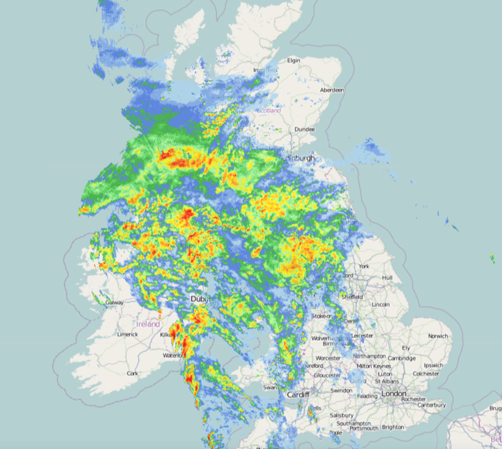
Storm Agnes hits the UK
|Netweather
There are three different rain warnings currently in place across the UK.
The affected areas are in Scotland from 3pm today until 3am tomorrow:
- Central, Tayside & Fife
- Grampian
- SW Scotland, Lothian Borders
- Strathclyde
- County Antrim
- County Armagh
- County Down
- County Fermanagh
- County Londonderry
- County Tyrone
- Central, Tayside & Fife
- East Midlands
- Highlands & Eilean Siar
- North East England
- North West England
- Northern Ireland
- SW Scotland, Lothian Borders
- South West England
- Strathclyde
- Wales
- West Midlands
- Yorkshire & Humber
13:00pm UPDATE: The southeast to avoid the storm
As #StormAgnes affects the north and west of the UK, the southeast will avoid the worst of its winds and impacts
— Met Office (@metoffice) September 27, 2023
In fact, a southerly wind will make it feel warmer with temperatures around 5°C above what we would usually expect at this time of year pic.twitter.com/K9pTCTHfDJ
The storm that is currently battering Ireland and soon to hit the UK, will avoid the southeast of England.
The region will see an increase of 5C from the average temperature that is usually expected this time of year.
12:45pm UPDATE: 'Danger to life' warning activated
A danger to life warning has been issued across the UK
|PA
A "danger to life" warning has been put in place across the UK.
A yellow weather warning came into effect at midday for a vast majority of Britain including Scotland, Wales, Northern Ireland, northern and southwestern parts of England.
The Met Office warn that "injuries and danger to life" are possible due to the poor weather conditions.
12:12pm UPDATE: Storm Agnes batters southern Ireland
A roof has just come off a building at Youghal Strand. Emergency services are en route. Avoid the area if possible! #StormAgnes pic.twitter.com/3Kn8HPTrRD
— Cork Safety Alerts (@CorkSafetyAlert) September 27, 2023
Winds from the storm have caused a roof to dislodge from a building.
Cork Safety Alerts posted footage of the falling roof online.
They said that emergency services are on their way to the scene.
People were advised to avoid the area if possible.
11:58am UPDATE: National Accidental Helpline issues advice
The Legal Operations Director at the National Accident Helpline has issued advice to those on the roads or those having to work during the storm.
John Kushnick said people should not leave their house if possible, however if they must leave for work purposes, has issued the following tips.
For workers:
- Avoid all work at height, do not consider going on any roof or near exposed edges, winds in excess of 23mph (Force 5) will affect a person’s balance and increase the chance of falls.
- Stop work in places with a risk of falling objects or collapse of temporary structures, partially built structures, unsupported gable peaks etc.
- Remove or secure loose materials which may be blown and become a hazard.
- Extreme care must be taken when working with wind fallen / damaged trees, they may be unstable with the risk of crushing for people involved in cutting and removing them.
- Access onto fragile roofs (corrugated iron, asbestos, PVC skylights etc.) damaged during the storm should only be undertaken with appropriate equipment to prevent falls through the roof.
Pedestrians and cyclists should also take extra care on the road, making sure that they are as visible as possible to drivers.
- Wear reflective and bright clothing.
- Use lights if you are on a bicycle (and indeed if you are walking or running in un- or badly-lit areas).
- Stick to well-lit paths and main roads.
- Check your windscreen wipers are working.
- Make sure all your lights are working.
- Reduce your speed.
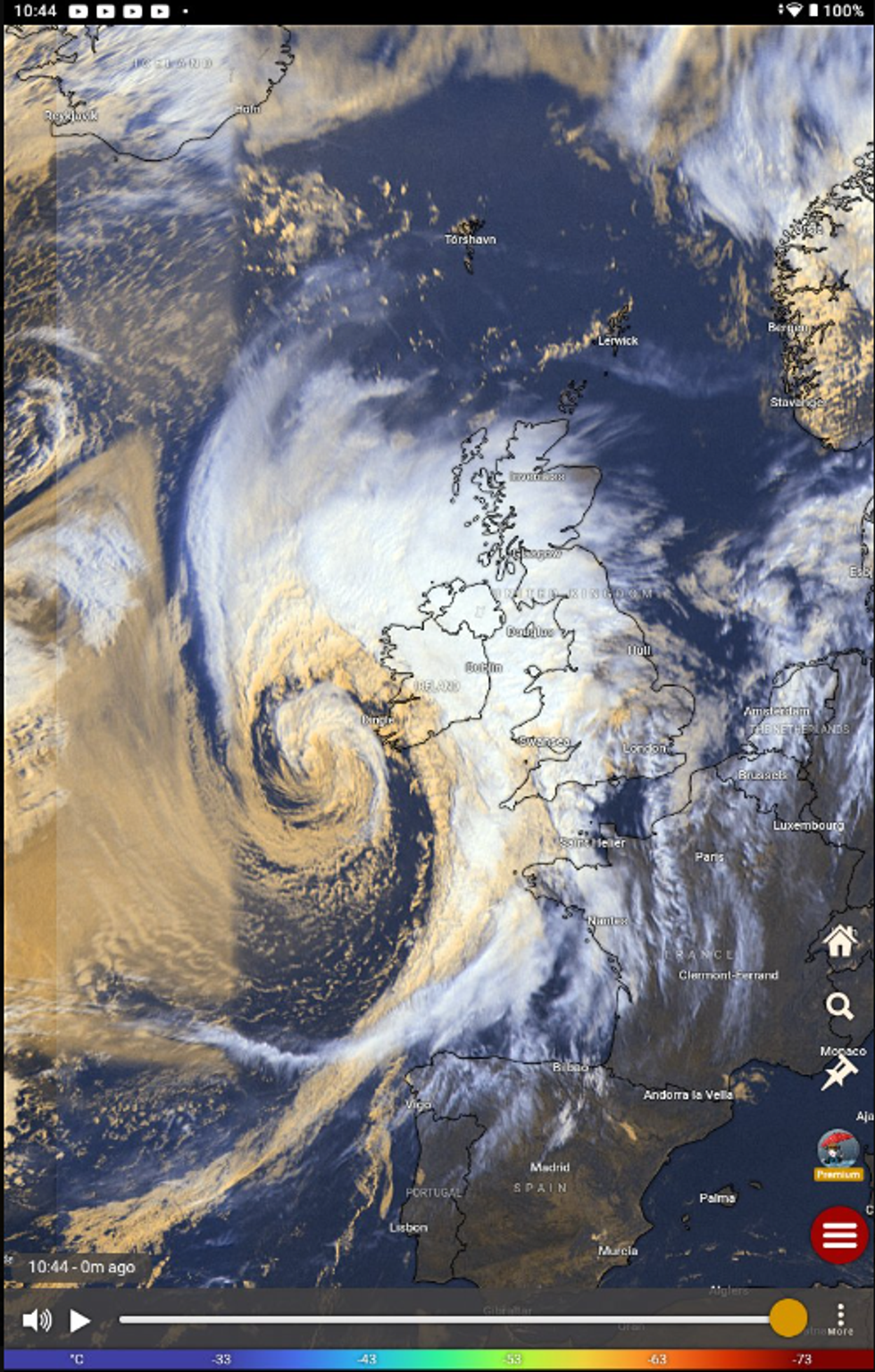
11:50am UPDATE: Storm Agnes can be seen from space
🛰️ The swirl of cloud associated with #StormAgnes can be seen from space
— Met Office (@metoffice) September 27, 2023
🌬️ Gusts of 65-70 mph have already been recorded in southwest Ireland
⚠️ Strong winds are expected to affect much of the UK as the storm tracks northeastwards this afternoon pic.twitter.com/na4QMCZwOA
The Met Office have said that the storm can be seen from space.
The weather office reported winds of up to 65-70mph in parts of Ireland.
The storm will soon hit the UK.
11:37am UPDATE: Ofgem warns about energy supply issues
⚠️Bad weather is on the way with yellow warnings in place for most of the UK especially the North
— Ofgem (@ofgem) September 27, 2023
📷 Save these emergency numbers on your phone in case of a disruption to your energy supply
Powercut? Call 105
Smell gas? Call 0800 111 999 #StormAgnes #EnergyAware https://t.co/Vw29KEGmgC
Ofgem, the Government regulator for gas and electricity markets, has warned residents that power and energy services may be disrupted because of the storm.
The regulator says the storm is set to bring in bad weather.
They provided the numbers of services to use if residents experience a power cut or smell gas.
11:30am UPDATE: Met Office updates weather warning
Four weather warnings are currently in place
|Met Office
The Met Office has updated their weather warnings on the storm as it moves closer to Britain.
They said: "As the confidence in the track of Agnes increases, the area of strongest winds has been refined by trimming out parts of northwest Scotland, and also by reducing the southeastern extent across England."
There are now four weather warnings across the UK.
This includes one for wind covering the majority of the UK and three for rain, one being for Northern Ireland and the other two for Scotland.
11:09am UPDATE: 68mph winds reported in Ireland
#CorkTraffic Reports of a tree down between Model Village, Dripsey and Kilmurry Pub. Take care on approach. #StormAgnes pic.twitter.com/juGcXhcunW
— Cork Safety Alerts (@CorkSafetyAlert) September 27, 2023
The Irish Met Office, Met Eireann, says 68mph winds have been recorded on an island off the country's south coast
"Sherkin Island recording a mean speed wind of 69kmph (44mph), gust 111 kmh (68mph)," the Irish Met Office said.
There have been fallen trees, power outages and flooding across Cork already this morning.
11:03am UPDATE: Scotland rain warning extended
A yellow rain warning that is in place for Grampian has been extended.
The warning area has been extended further east and north, now covering Perth, Dundee and Aberdeen.
The Met have warned that it may cause flooding in some areas.
10.50am UPDATE: Latest position of Storm Agnes
Storm Agnes lingering on the coast of Ireland
|X
Latest position of Storm Agnes as heavy rain continues to spread North East. Winds starting to pick up on the coast.
Observations and radar from Met Eireann show Storm Agnes gusts of up to 48kmh in Dublin and in excess off 100kmh in Cork
10.43am UPDATE: Devon and Cornwall issue warning
Devon and Cornwall roads and policing teams have issued a serious warning to drivers travelling in the next couple of hours.
An official said: "Storm Agnes is incoming across the southwest. Please drive carefully and to the conditions. Flooding and highwinds are expected on our roads."
10.38am UPDATE: Storm Agnes reaches Ireland
#StormAgnes has arrived in Clonakilty Bay with driving rain accompanying the wind. pic.twitter.com/XJaTAG0uiE
— WalterDog (@WalterofWexford) September 27, 2023
Parts of the Ireland are already feeling the impacts of Storm Agnes.
10:09am UPDATE: Storm Agnes currently over Ireland
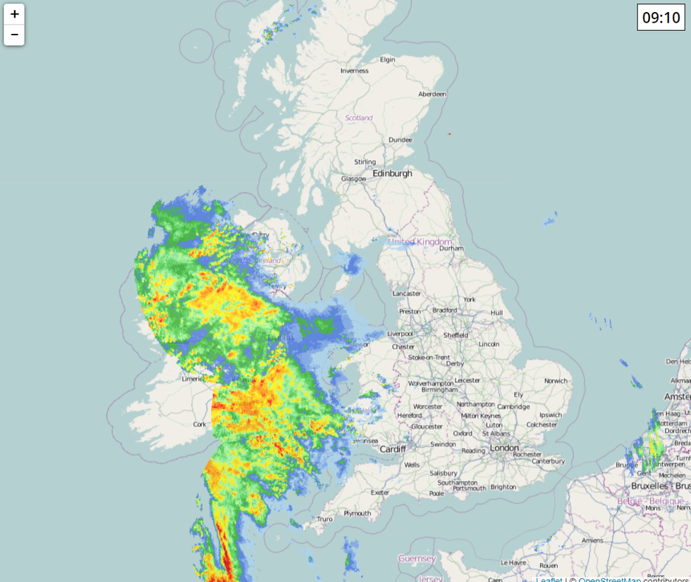
Storm progress at 09:10
|Netweather
Storm Agnes is currently above Ireland and Northern Ireland.
The Met Office has just issued a Yellow rain warning for Northern Ireland.
It has been reported that around 08:55, the storm made windfall in Clonakilty, Cork.
Met Eireann has warned of possible flooding, difficult travel conditions, power outages and some fallen trees as the storm makes landfall.
10:00am UPDATE: Met Eireann issue Orange and Yellow weather warnings
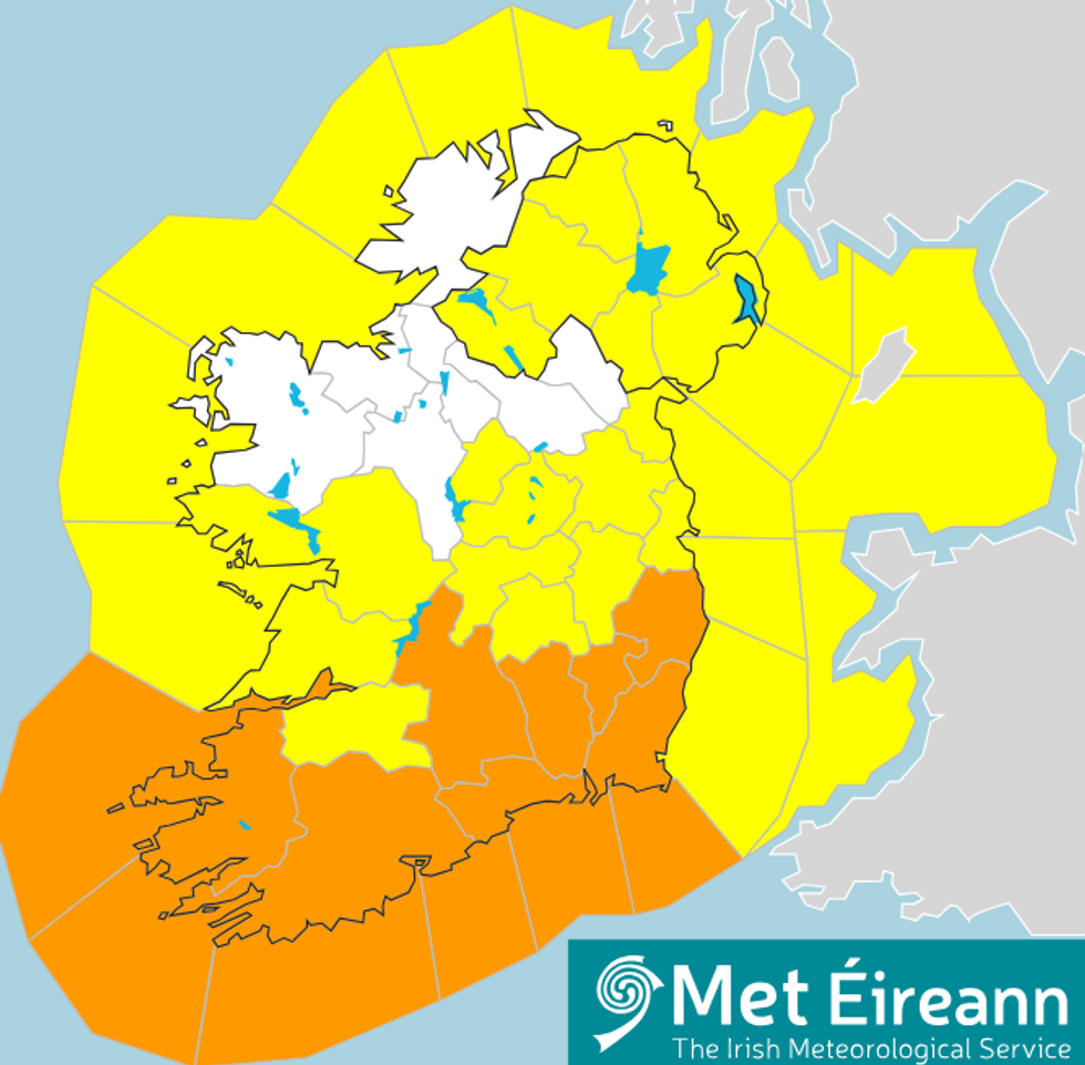
Weather warnings across Ireland and Northern Ireland
|Met Eireann
Met Eireann, meteorological service of Ireland, issued a Yellow and Orange Weather Warning ahead of the expected arrival of the storm.
The warnings runs from 7am on Wednesday 27 September till midnight on Thursday 28 September.
There are orange wind warnings for Carlow, Kilkenny, Wexford, Wicklow, Cork, Kerry, Tipperary and Waterford.
Orange rain warnings are affecting counties Cork, Kerry and Waterford.
Yellow wind warnings are in place for Carlow, Dublin, Kilkenny, Wexford, Wicklow, Cork, Kerry and Waterford.
Meanwhile yellow rain warnings are in place for Leinster, Munster and Galway.
In Northern Ireland, a yellow wind warning has been issued for Antrim, Armagh, Down, Fermanagh, Tyrone and Derry.