


The Met Office has issued a major 27-hour rain warning stretching over a huge portion of the UK.
The British weather service warned heavy rain will reach southwest Britain on Thursday evening, before spreading across much of England and Wales on Friday.
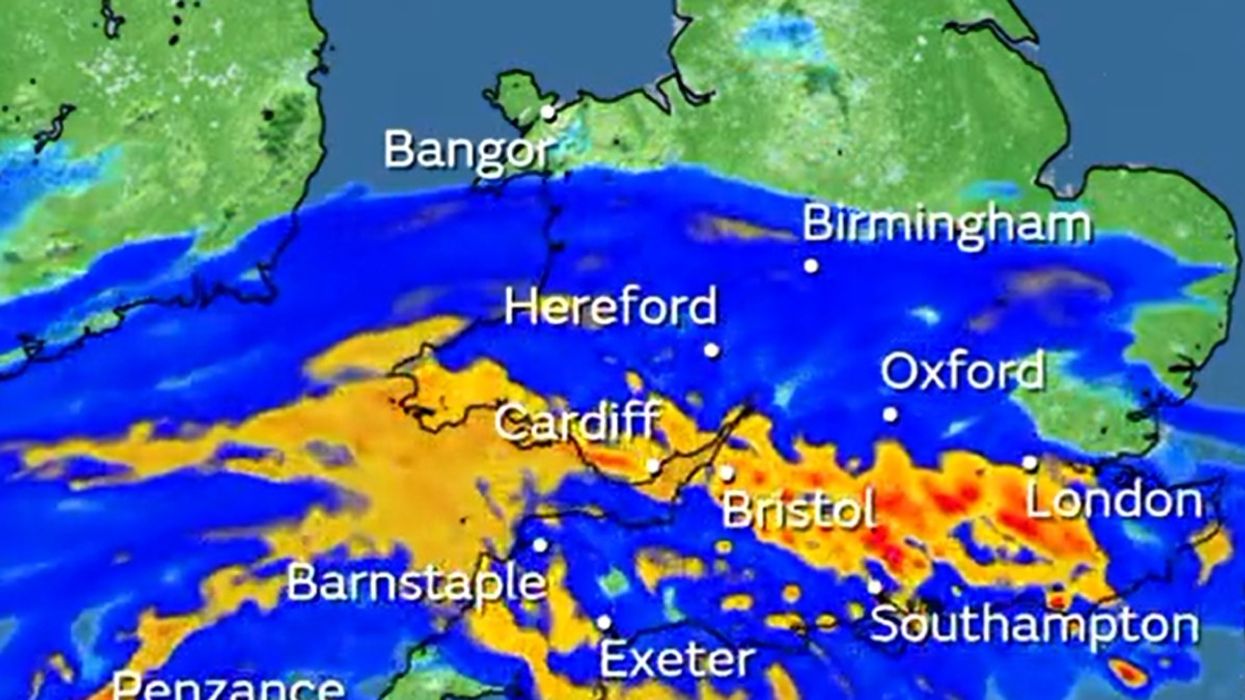
According to service, the heaviest rainfall could see parts of the country flooded by 60-70mm of rain.
The service also warns that in the south, there are the possibility of thunderstorms.
WATCH NOW: Weather outlook 11/10/2023
Starting at 9pm on Thursday, the warning is set to last until midnight on Friday.
In an urgent alert, the Met Office wrote: “Rain, heavy and persistent at times, is expected to develop through Thursday evening, before affecting much of England and Wales through Friday.
“Rain gradually clears from the north through Friday afternoon and evening.
“Widely 10-20mm of rain is likely but in the wettest spots 30-50mm is possible, and some high ground of Wales especially could see 60 to 70mm.
LATEST DEVELOPMENTS: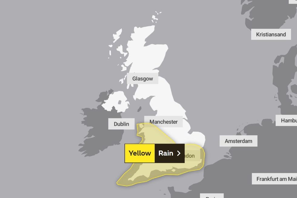
Met Office issues major rain warning
|Met Office
“Across the south of the area its possible some thunderstorms may break out, and these could bring 20-30 mm of rainfall in a couple of hours.
Areas affected are set to be East Midlands, East of England, London & South East, North West, South West, Wales and the West Midlands.
According to the Met Office, spray and flooding on roads should be expected and drivers have been urged to take care as journey times could be longer.
They added that flooding of a few homes and businesses is likely and that public transport such as bus and train services could affected.
The warning comes as a “cold snap” will bring freezing temperatures to the UK.
Expected in the coming days, the temperature could plummet to -1C.
Met Office Deputy Chief Meteorologist, Brent Walker, said: “As we head through second half of this week cold air will push southwards across the country and there is a risk that showers over mountains of Scotland could turn wintry. By the weekend we expect all regions of the UK to be in the cold airmass and overnight frosts are possible.
“With high pressure continuing to dominate our weather early next week, it will start largely fine, settled, and cool by day, with cold nights and a risk of rural air frosts in places.
“Any early morning mist or fog should clear quickly and there could be a few showers possible around some coasts at times.”