


A new "Medieval Murder Map" project is unveiling grisly patterns of violence in English cities in the 14th century.
Researchers are examining coroners' inquests in London, York and Oxford between 1296 and 1398, and have collated data from 355 killings in that time.
The emerging results are patterns of violence which appear to match those in modern cities.
The study, which was published in journal Historical Criminology, has revealed that homicides tended to centre around markets, thoroughfares, bridges and ceremonial routes.
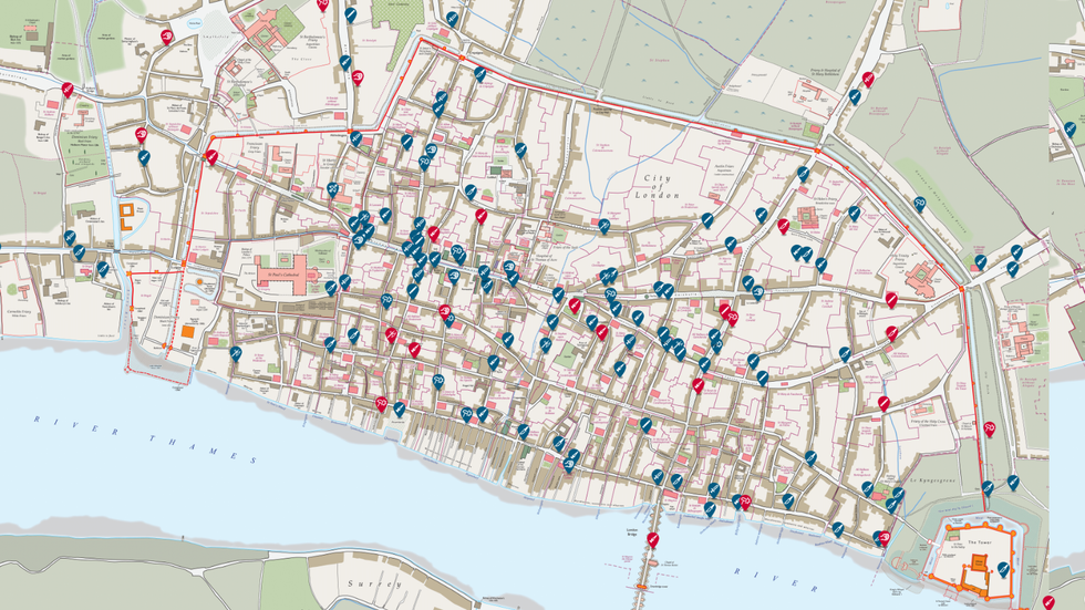
In London, the waterfront of the River Thames was troubled by fights among sailors and merchants
|UNIVERSITY OF CAMBRIDGE
Sundays and evenings - especially after curfew - were the most dangerous times of day.
Criminologist Manuel Eisner from the University of Cambridge has spent 15 years collating the maps, and said: "Each of these stories shines a little spotlight on an event in some corner of London."
He added: "Homicide was much more frequent than it is in modern times."
Oxford was the most dangerous city, with a homicide rate of around 100 per 100,000 inhabitants - while London and York hovered at 20 to 25 per 100,000.
For comparison, in 2023 London's homicide rate was 1.2 per 100,000 inhabitants.
MORE ARCHAEOLOGY NEWS:
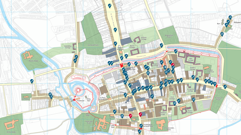
The University of Oxford attracted thousands of young men, often from hundreds of miles away
|UNIVERSITY OF CAMBRIDGE
This is because the University of Oxford attracted thousands of young men, often from hundreds of miles away.
Within Oxford, there was a particularly high concentration of murders in and around the university quarter, believed to be because of high tensions between townspeople and students, as well as strong rivalries between students themselves.
The students also engaged in fights without fear of punishment as clerical privileges often protected them from prosecution.
London had a different pattern of violence, with the commercial and ceremonial hub of Westcheap seeing murders connected with guild conflict and public retaliatory attacks.
Additionally, the waterfront of the River Thames was troubled by fights among sailors and merchants.
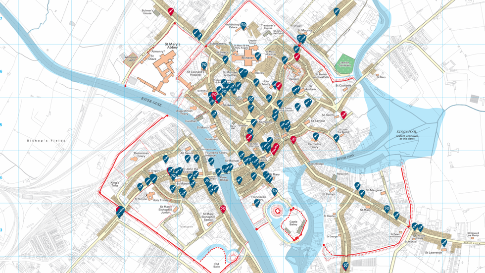
Micklegate and Ouse Bridge, both key city gateways, alongside Stonegate, which was on the procession route to York Minster, were common stages for homicides
|UNIVERSITY OF CAMBRIDGE
In York, Micklegate and Ouse Bridge, both key city gateways, alongside Stonegate, which was on the procession route to York Minster, were common stages for homicides.
According to researchers, the most surprising find from the study was that in medieval times, poverty did not seem to be the primary cause of murder.
Data from the "Murder Map" shows that wealthy areas had more murders than poorer districts.
Scholars believe this could be due to public spaces providing both opportunity and audience, making them ideal places for defending honour and displaying power.
Because medieval society tended to focus on honour in public, killings were often staged before an audience, rather than stemming from private disputes.