Meteorologist breaks down in tears live on air as he details horror growth of Hurricane Milton from Category 1 to 5 in just 18 hours

Meteorologist breaks down in tears live on air as he details horror growth of Hurricane Milton | NBC Miami

The expert apologised for his tears as he continued to explain how the storm grew to such strengths
Don't Miss
Most Read
A Miami meteorologist has struggled to contain his emotions during a live broadcast as he reported on Hurricane Milton's rapid intensification to a Category 5 storm.
On live TV, John Morales choked back tears, describing the hurricane as "incredible" and "horrific".
"It's just an incredible, incredible, incredible hurricane," he told NBC Miami, his voice breaking as he detailed the storm's catastrophic drop in pressure over a 10-hour period.
The powerful storm is now poised to deliver a devastating blow to Florida's already battered coast. Forecasters warn of life-threatening storm surge, flooding rains, and damaging winds.
Milton's swift escalation from a Category 1 to a Category 5 hurricane in just 18 hours has left meteorologists and climatologists across the country stunned.
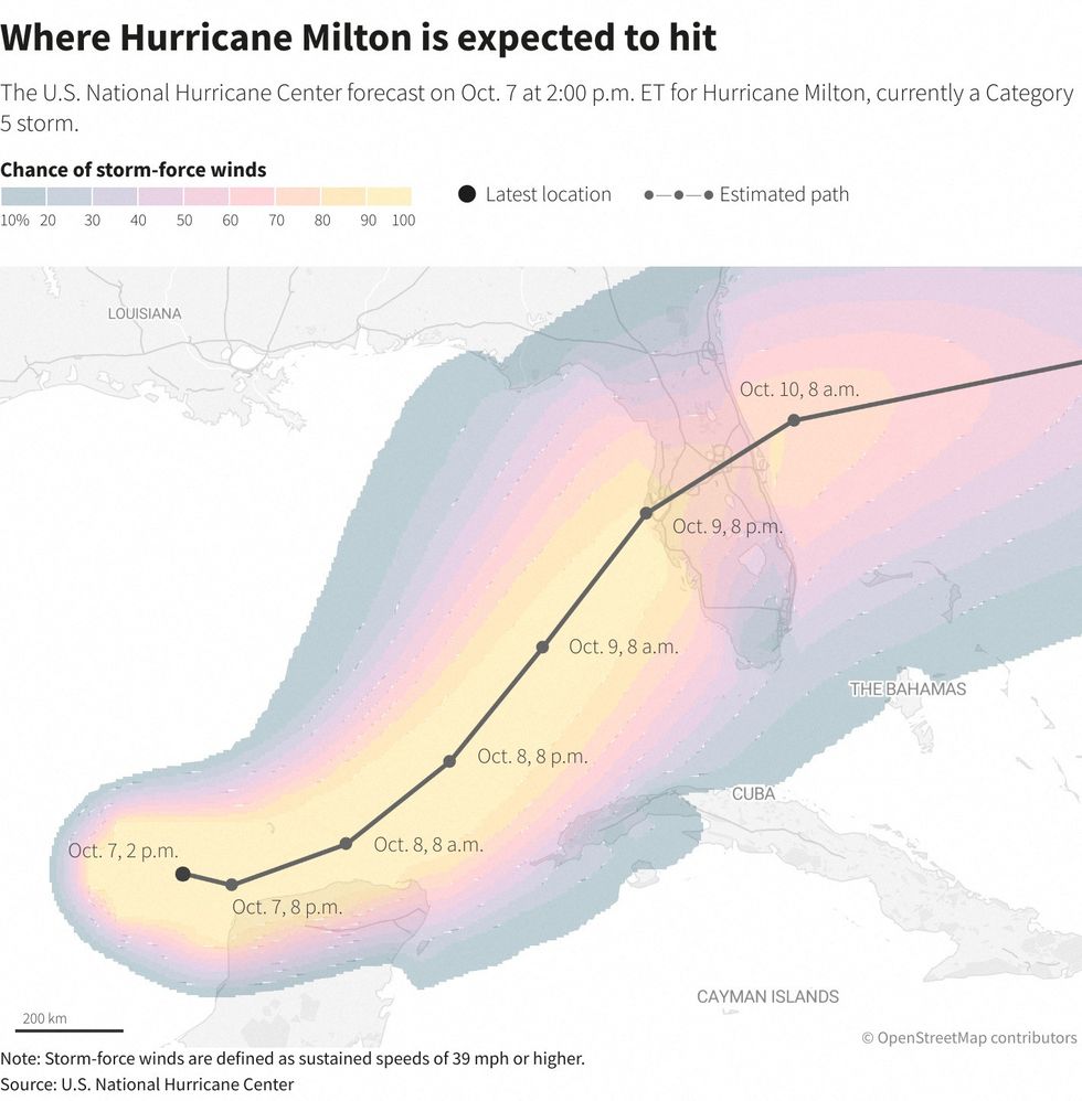
Hurricane Milton is forecast to make landfall near Tampa, Florida, on Wednesday as at least a Category 3 storm.
 Meteorologist breaks down in tears live on air as he details horror growth of Hurricane Milton | NBC Miami
US LATEST:
- Putin suffers humiliation on his birthday as Ukraine hacks state TV in 'unprecedented' attack
- Eddie Hearn makes 'sad' Mike Tyson dig before brutal swipe at Jake Paul over controversial fight
- Donald Trump pledges that the US will 'reach Mars' if he's re-elected
The National Hurricane Center has issued hurricane watches across portions of Florida, warning of potential life-threatening conditions.
Rainfall is expected to be 5-10 inches, with up to 15 inches possible in some areas. A deadly storm surge of 8-12 feet is also forecast for the Sarasota-Manatee region.
Evacuations were set to begin on Monday in parts of multiple counties. As of early Monday, Milton was centred 750 miles west-southwest of Tampa, moving east-southeast at 8 mph.
Ryan Truchelut, chief meteorologist for WeatherTiger, described Milton and the recent Hurricane Helene as potentially "among the most devastating one-two punches ever to hit Florida".
I debated whether to share this. I did apologize on the air. But I invite you to read my introspection on @BulletinAtomic of how extreme weather 📈 driven by global warming has changed me. Frankly, YOU should be shaken too, and demand #ClimateActionNow. https://t.co/09vxgabSmX https://t.co/GzQbDglsBG
— John Morales (@JohnMoralesTV) October 7, 2024
Morales linked the storm's intensity to climate change, stating on air: "You know what's driving that. I don't need to tell you — global warming, climate change leading to this."
He explained that the Gulf of Mexico's record-hot waters are acting as fuel for tropical storms.
The meteorologist later shared his thoughts on social media, urging viewers to demand "Climate Action Now".
In a recent article, Morales described Hurricane Helene as a "harbinger of the future", detailing how climate change has altered his approach to storm risk communication.

Predicted path of Hurricane Milton
|REUTERS/US National Hurricane Center
"Extreme weather events, including hurricanes, are becoming more extreme," Morales wrote.
"I must communicate the growing threats from the climate crisis come hell or high water — pun intended."
Scientists attribute the increasing frequency of rapid intensification in hurricanes to human-caused climate change, as warming oceans provide more energy for storm development.
The rapid intensification of Hurricane Milton has left meteorologists and residents alike grappling with the severity of the situation.

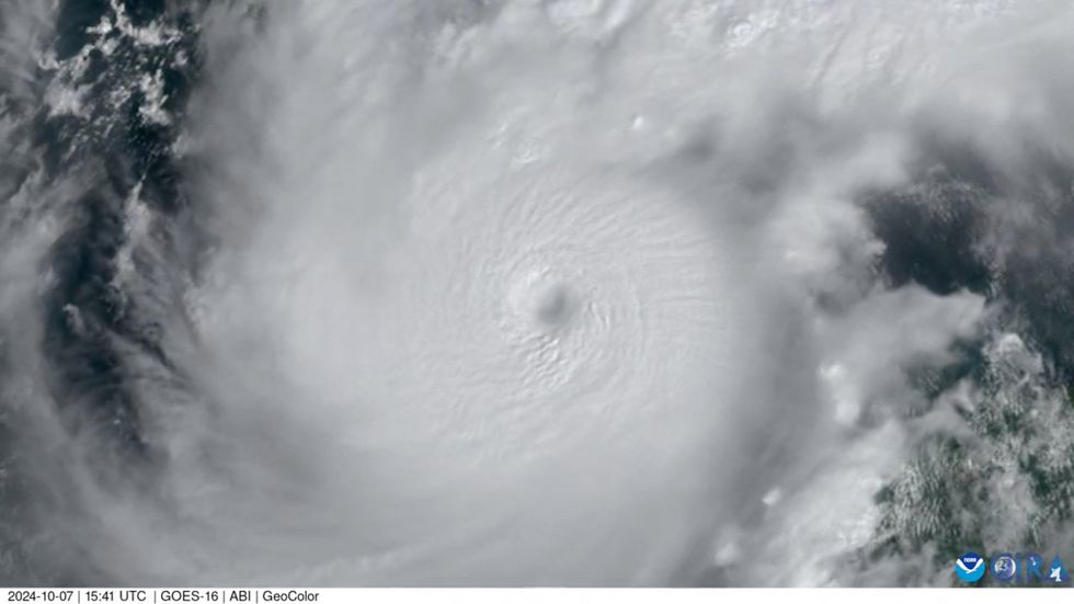
Satellite image of Hurricane Milton
|REUTERS
This phenomenon, where a storm's maximum sustained winds increase by at least 35mph in 24 hours, is becoming increasingly common due to climate change.
Milton's winds exploded from 100mph to 175mph in just nine hours, surpassing even the worst forecasts.
The storm's development has left many experts "with no words", according to social media reports.
This comes as Florida and the US Southeast are still reeling from the impacts of Hurricane Helene, which struck just two weeks ago.
WeatherTiger's Ryan Truchelut summed up the sentiment: "We're all exhausted already. You are, I am. That's reality."


